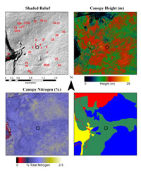
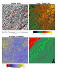
LiDAR Images in .pdf
2km x 2km 1km x 1km
500m x 500m 200m x 200m
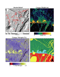
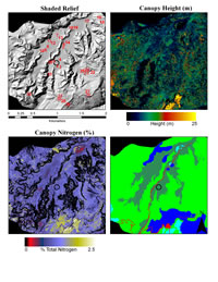
Following are links to images of the LSAG sites with a spreadsheet
for each containing detailed information
~ These pages may take a few seconds to load ~
LiDAR Images in .pdf |
|
|
This research funded by a grant from the National Science Foundation
Website construction by Doug Turner