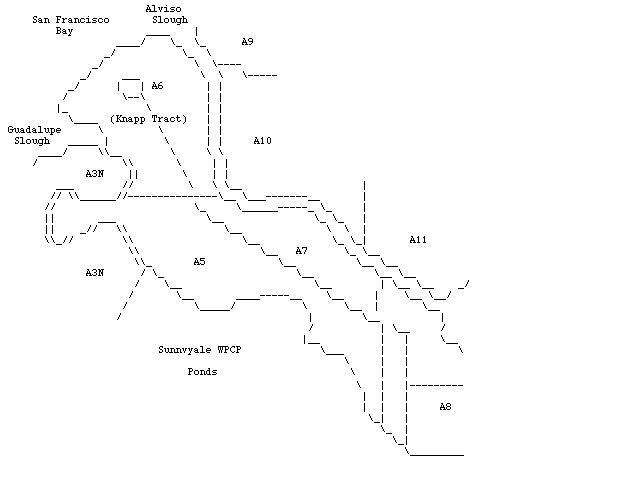
North is at the top. The focus of this map is the set of ponds between Guadalupe and Alviso sloughs. Unfortuntately, none of these ponds are accessible to mortals and are all behind locked gates. The outer part of this section is the Knapp Tract (Salt Pond A6) which is owned by the San Francisco Bay National Wildlife Refuge and will at some point, probably, revert to salt marsh, with or without man's assistance. The San Francisco Bay Observatory does survey work on these ponds so you may visit them if you volunteer with SFBBO.
You might also be able to make a winter visit if you participate in the San Jose CBC. The San Francisco Bay is at the upper left and I have noted the slough entrances. The Sunnyvale salt ponds are to the lower left and, across Alviso Slough, are the Alviso salt ponds that are accessible by a public trail (see Alviso Salt Ponds, Part 2). I ran out of space on A8, but if you continue the map to the lower right you will come out on Gold Street in Alviso. The Gargill entry road is between junk yards just south of the Gold Street Bridge over Guadalupe River/Alviso Slough in Alviso. The most famous aspect of these ponds is the Knapp Tract or Knapp Property that SFBBO has been monitoring for 15+ years. [WGB, 2 Jan 97]