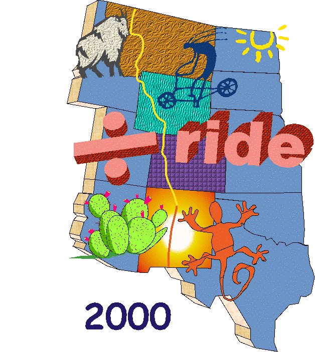
The ÷ Ride
Stage IV
Summer 2000
Notes:
1) Because of the kind of terrain (e.g., high mountain passes), the total trip mileage will be less this year;
2) It is much harder riding than we have done previously, and therefore the daily mileages will be less;
3) I've planned for 3 rest days...a single day in Salida, CO, and then two days in Del Norte, CO (and then the following day we climb Indiana Pass at 11,000+ft.) This will allow for limited sight-seeing and energy recuperation prior to the day of Indiana Pass. :-)
4) I tried to figure out a two-week bail out. It may be difficult to do, but not impossible, from Del Norte.
5) The only obvious end point this year is Albuquerque. I have mapped the route with that in mind. I did considerable trail research last weekend while I was there, and it was useful. I changed the last day or two of the trip based on what I discovered.
6) There is a day or so at the end to visit Santa Fe (state capitol) and possibly Taos. Both neat towns!
7) I've also plotted out next year's route, which is much flatter, and will allow for more miles/day than this coming year. Our challenge next year will be to get to the actual start of the ride out of ABQ, and leaving Antelope Wells so that we can get to an airport (El Paso???). (Pedal to El Paso?)
8) Because of summer monsoon rains in NM, and what that does to the roads, AND because most of you seemed to prefer July 10th as a start date (our usual Monday in July), I'll plot things using that day. Sunday July 30th or Monday July 31 would be good departure dates from ABQ. Also, because we are starting in "earlier July" rather than "later," I suppose we could have some snow problems at the north end of the route in Colorado. We should be prepared for that.
(There is much work to be done with the itinerary. I just wanted to get it up so that you know that I am working on it. :-)) )
June 27th: All comments with (MM) attached to them are from Mac McCoy's new book "Cycling the Great Divide."
Possible/Probable DR Riders, Y2K:
Denver Motel: (Comfort Inn Airport; 16921 E. 32nd Avenue; phone: 303.367.5000)
|
Day |
To / From |
Miles |
~Alt. Gain |
Camping |
Services |
Comments |
|
0 Sat/Sun 7/8 & 7/9 |
Frisco, CO |
- |
- |
Sky-Vue Motel Heated indoor pool; all rooms on ground floor. Reservations for 8 rooms (two beds/room) are confirmed for July 8th & 9th. Rooms are in the name of "Divide Ride Dogs." We each need to guarantee our own room by June 7th. Current price is $63/night (probably...they don't have the books for July ready yet...don't call until April). |
All. Many bike shops in town. |
Amazing shopping experience available at Silverthorne outlet malls, a few miles downhill from Frisco. :-) |
|
1 Mon. 7/10 |
Frisco -> Breckenridge -> Como |
30.6 |
~3,000' |
- |
Lunch in Breckenridge?
Much to do in Breck. Many restaurants. Popular ski area. "In
summer, ski mountains are transformed into thrill rides."
Super Slide
and Amaze'n Breckenridege (Colorado's largest human maze). (Como) (Restaurant and B&B are closed on Tuesday and Wednesday.) "It's arid country...be sure to stock up on water before leaving Como." (MM) |
Bike Trail, Frisco to Breckenridge: 9.5 miles, rated "easy" in the "Summit Country Bike Trail Guide." They say, "One of the heaviest used sections in the Summit Cty. bike trail system. Anticipate large numbers of bikes & inline skaters. Bike Trail, Boreas Pass, 12.5 mi. rated "easy" (as above). "Dirt road. Well-maintained and gradual, this road is excellent for novices. If the gate is closed, then the trail is still snowy and wet and must be avoided bycyclists. Can have heavy traffic on weekends [shouldn't be a problem for us]. Be prepared for changing weather as the Pass is above the timberline. The ride follows an abandoned r.r. grade, originally the route of the Denver, South Park and Pacific RR. Fairly smooth dirt road climbs graduallythrough beautiful aspen groves, making it a superb ball ride. Pass Baker's Tank which stored water for r.r. use at 3 miles (there is a Baker's Tank Look Ride also...(5.5 mi; "moderate" difficulty; 1-2 hrs.; dirt road and trail). Continue climb along flank of Bald Mt. At the pass, you'll have incredible views from the Divide. Perched near the road is the recently restored Boreas Pass sectionhouse. The road continues another 11 miles down to the vast expanse of South Park and the small down of Como." Boreas Pass Road: "Scenic unpaved alternative to the highway, a wide and well-maintained gravel road that follows an old narrow gauge r.r. route as it gradually climbs above the timberline to cross the ÷. Remains of old ranches and r.r. buildings dot the landscape on this spectacular drive, which brings you out at the ghost town of Como." [Hidden Colorado] Boreas Pass:÷Crossing #15 (for trip) on first day, the highest divide crossing on the route. Take your aspirin before coming to altitude (if you follow this regime), come a couple of days early if possible for altitude acclimation. We begin pedaling at 9,500' and immediately climb to 11,500' today. We descend to 10,500 at Como so that we can "sleep low." (It's all relative!) Como
named for Lake Como in Italy. "Striking old rock roundhouse
in Como." (ACA map commentary.) |
|
2 Tues. 7/11 |
Como -> Hartsel |
30.3 |
400' |
- |
(Hartsel)
Groceries: (From the web) |
A day of descending. Hartsel: There seems to be a lot of rocketry info on the web associated with Hartsel. |
|
3 Wed. 7/12 |
Hartsel -> Everett Cow Camp Shacks (?) or at Mile 104.1 |
30.6 or a couple more. |
~2,100' |
Free-style camping |
- |
- |
|
4 Thur, 7/13 |
Cow Camp -> Salida (Name means "exit" - it was the exit from the valley for mines in the Leadville area.) |
17 |
~400' |
Riverside Lodge Motel and Family Campground. Many motels in Salida. Heart of the Rockies c.g. (pvt) in Poncha Springs, 5 miles down the route from Salida. AAA campground Laundry, pool, limited groceries. Numerous other camping areas "in" Poncha Springs. "River Run Inn used to be the country poor farm where indigents were sent to work for room/board. Now is a hostel/B&B with 13 bed dorm on top floor and 7 individual guest rooms. 8495 County Road 160. Salida. 719-539-3818; 800-385-6925." [Hidden Colorado]
|
All services. Country Bounty Rest: "Huge portions of home cooking. Family style restaurant has varied menu ranging from fresh Ark. R. trout to Mexican food to homemade soups, etc. Ambience more like a gift shop than restaurnt with country crafts, Indian jewelry and curios." 423 W. Rainbow Blvd. Laughing Ladies Cafe: Intern'l specialties; vegetarian entrees, thick steaks w/ butter-garlic sauce, fresh bakery goods, brew pub beers. (This is a Dog's Place!!) 128 W. 1st St. Windmill Rest: Tex-Mex, steak, seafood. Decor is the attraction with extensive collection of old-time advertising memorabilia. [Hidden Colorado]
|
Mostly downhill. Watch for the "14-ers," of the Sawatch Range...peaks jutting up more than 14,000' Salida: "An arresting town that reatures oe of the
most extensive historic districts in Colorado." (ACA map
commentary.) "Voted 'favorite town of the DR.'" (MM) Good area for rockhounds. (Aquamarine, topaz, quartz, garnet, sapphire, tourquoise). Salida Museum: adjoins CofC building. Jeep tours: various length jeep tours into the CO gold country. Rafting and horseback trail rides also available. (719) 539-2962. Whitewater rafting. Arkansas R. Arkansas R. swells to floodstage in mid-June, with accompanying kayak challenges. "One of the top white water rafting areas in Colorado." (More people go rafting here than any other river in America.) (MM recommends doing a raft trip.) Hot springs pool. Open 1-9p.m. Adults, $5. 410 W. Rainbow Blvd. |
|
5 Fri. 7/14 |
Day Off |
- |
- |
- |
- |
- |
|
6 Sat. 7/15 |
Salida -> Poncha Springs -> near Marshall Pass |
19 |
3,000' |
- |
"Stock your larder before leaving Salida because its many days and 153 miles to Del Norte, the next town of any size." (MM) |
"Roads leading into Del Norte are really primitive, in some places not much more than a sandy track through a wash in the desert - there are higher-grade road alternative if you want them. [Posted to the touring list by AWunder@aol.com] Alt. Route (on map) for Melissa/Tom? :-) "very rocky road to climb 3,000' in 7 miles...Regain main route at Marshall Pass." Marshall Pass, 10,842': Crossing #16. Opportunity to mt. bike Monarch Pass either this afternoon or tomorrow morning. (See ACA map comments about Monarch Pass.) Monarch Crest Tram: Tram ascends to 12,000' for views of Rockies/Pikes Peak. |
|
7 Sun. 7/16 |
Marshall Pass -> Sargents -> Monarch Valley Ranch |
27.1 |
600' |
Call Monarch Valley Ranch about
camping there. |
EXTREMELY limited services in Sargents. |
- |
|
8 Mon. 7/17 |
Monarch Valley Ranch -> Moss Lake (?) |
28 |
1,800' |
Free-style camping. |
- |
- |
|
9 Tues. 7/18 |
Moss Lake -> Luders Creek c.g. |
16.5 |
1,600' |
Surface water generally available.(MM) |
- |
Cochetopa Pass, 10,032': Crossing #17. |
|
10 Wed. 7/19 |
Luders Creek c.g. -> Storm King c.g. |
29.7 |
2,800' |
"Stream water is generally accessible during most of the day." (MM) |
- |
"Bike trails found in the vicinities of both Luders Ck.
c.g. and Storm King c.g." (MM) |
|
11 Thur. 7/20 |
Storm King c.g. -> El Garita (off route) -> Del Norte |
32.2 |
600 |
(From the web) Camping is allowed in the City Park. Check with Police Dept. (See ACA map verbiage.) La Garita Creek Ranch 38145 County
Road E-39 Del Norte, Colorado 81132 VOICE- 719-754-2533 |
Del Norte: There is a restaurant/cafe at the Del
Norte Motel & Cafe Museum, dining, lodging, shopping. (Gary B's frriend) "I have friends in Del Norte; David Off is a MTB rider and his family owns a ranch there. He is very knowledgeable about the area and current conditions. 719 657-3844 davidaoff@hotmail.com Tell him hi for me, we went to Peru together." |
La Garita: 2 mi. off route. Limited services; closed Mondays. AAA map indicates camping here also."...miniscule village ...mercantile... Spanish style church...It's worth pedaling the extra miles just to capture the scene in your mind and/or on film." (MM) Del Norte Rio Grande County Museum: 580 Oak Street. If you need to leave, this is probably the best place to jump ship and try to arrange transportation to Colorado Springs or Denver. Getting out anywhere will be difficult, but Del Norte is a tourist route west to Durango and east to I-25 (north to Pueblo and Colo. Springs; south to Albuquerque). So far, I haven't found any information about buses to Denver, etc. However, Alamosa ("relatively close by) has United Express air service. (Alamosa is noted for year 'round notoriously awful weather. Numbingly cold in the winter, windy the whole year.) |
|
12 Fri. 7/21 |
Day Off. |
- |
- |
- |
- |
- |
|
13 Sat. 7/22 |
Day Off. |
- |
- |
- |
- |
- |
|
14 Sun. 7/23 |
Del Norte -> Indiana Pass -> Summitville c.g. OR Stunner c.g. |
33
42.5
|
4,500
? |
- |
"Next few days are tricky in terms of finding things to eat. Stock up in Del Norte and begin to think like a backpacker." (MM) THE WATER IN SUMMITVILLE IS NON-POTABLE. THIS IS A SUPERFUND SITE. We may want to rethink our "camping" and camp at Stunner c.g. "Stock up on water in Del Norte to last til Stunner Pass." (MM) |
(See map commentary about early a.m. start out of Del Norte.) "Best ridden on weekend to avoid weekday logging traffic." Approximately 4,000' altitude gain in 24 miles. Indiana Pass, 11,910' is the highest pass on the whole Divide route! Yee-haw!! Revise route to easier east or west
roads if necessary. |
|
15 Mon. 7/24 |
Summitville c.g. or Stunner c.g. -> Platero -> Mile 23.0 BASED ON (MM), WE MAY WANT TO MODIFY OUR DAILY ROUTES TO COINCIDE WITH SOME OF HIS.
|
38.5 |
2,000 |
Camping at motel at mile 23? Numerous camping sites between miles 16-23. |
Lunch/groceries in Platero. Cafe/groceries/motel at Mile 23.0 (See ACA map Service Info) |
|
|
16 Tues. 7/25 |
Mile 23 -> Mile 52.2 c.g. |
30 |
3,000' |
"Stream water is abundant." (MM) |
- |
Cumbres & Toltec Scenic
R.R.: "The 64 mi.
Antonito<->Chama trip is America's longest and highest
narrow-gauge steam train route still operating. Climbs by
swooping loops through forests of aspen up to Osier, a mt.
ghost town that is inaccessible by car." |
|
17 Wed. 7/26 |
Mile 52.2 -> Hopewell Lake |
35.1 |
1,000' |
"Hopewell Lake is a pleasant pack-it-in/out campground." (MM) |
Something to consider: Sent to me by Gary on the touring list, who lives in Albuquerque: "One more option, and it goes through
the prettiest parts of the state IMO. |
"Roads on the route in northern New Mexico were generally terrible - deep ruts, huge rocks, little or no grading and upkeep. Water was scarce." [Posted to the touring list by AWunder@aol.com] Based on what we decide to do, we may make a major modification in our route based on the information in the column to the left. From Santa Fe there is the Turquoise Trail on scenic back roads which takes you to Albuquerque. |
|
18 Thur. 7/27 |
Hopewell Lake -> El Rito |
40.2 |
~1,300' |
"Frequently surface water." (MM) |
ACA seems to think that there are "services" in El Rito. When I was here (early December) there was extremely(!) little. Perhaps things perk up in the summer. We need to be prepared to find not much of anything available to us except a gas station. |
- |
|
19 Fri. 7/28 |
El Rito -> Left on Hwy 84 -> Espanola -> Santa Fe |
~53 |
500' |
- |
Depending on weather (NM summer rainy season begins soon), May/June (possible) fire damage to the area, our weary bodies, etc. etc etc. we may choose to follow the DR route to Cuba, NM, veer east tonm the highway (good road!) to ABQ, and then rent four-wheeled transport vehicles to explore Santa Fe/Taos. |
Mostly flat on pretty good roads. Rte. 554 from El Rito to the main hwy. juncion (84) goes through Carson National Forest ("forest" is relative...) Spectacular rock formations on your right, views on your left. Two lane road, no shoulders. The road from Espanola to Santa Fe is very busy and looked rather unsuitable for cycling (narrow-to-no-shoulder on a major highway). I will be in touch with bike clubs to see what they might recommend for a route into Santa Fe from where we are. We may have to alter our route and come in from the North along "real roads."
|
|
20 Sat. 7/29 |
Santa Fe |
- |
- |
- |
- |
- |
|
21 Sun. 7/30 |
Albuquerque |
-50 miles |
- |
- |
"You can reach me at 505 254-3519 or cell 505 269-4106." (Gary B.'s contact info.) |
Shuttle? Pedal? More information to be collected.
|
1-877-864-6985
This number will provide information on fire restrictions on public lands in the Southwest, including national parks, national monuments, national historical parks, national forests, national wildlife refuges, state parks, and U.S. Army Corps of Engineers recreation sites. For information on the statewide fire situation New Mexico, call the Fire Information Desk in the Southwest Coordination Center in Albuquerque, New Mexico, at 505-842-3473. Or, access the "Fire Information" page on the Southwest Area Website at http://www.fs.fed.us/r3/fire. For more localized information you can call the individual National Forests for updated reports:
Carson National Forest 505-758-6200
Sante Fe National Forest 505-988-6940
Cibola National Forest 505-388-8201
Gila National Forest 505-388-8201
Bold = City (or food option)
Bold/Italic - Item of
interest
Updated: July 1, 2000